White Island Volcano
Updated: 16. Mai 2024 15:25 GMT -
stratovolcano 321 m / 1,053 ft
Neuseeland, -37.52°S / 177.18°E
Aktueller Status: unruhig (2 von 5)
Neuseeland, -37.52°S / 177.18°E
Aktueller Status: unruhig (2 von 5)
Last update: 13 Feb 2024 (low level steam and gas emissions continue)
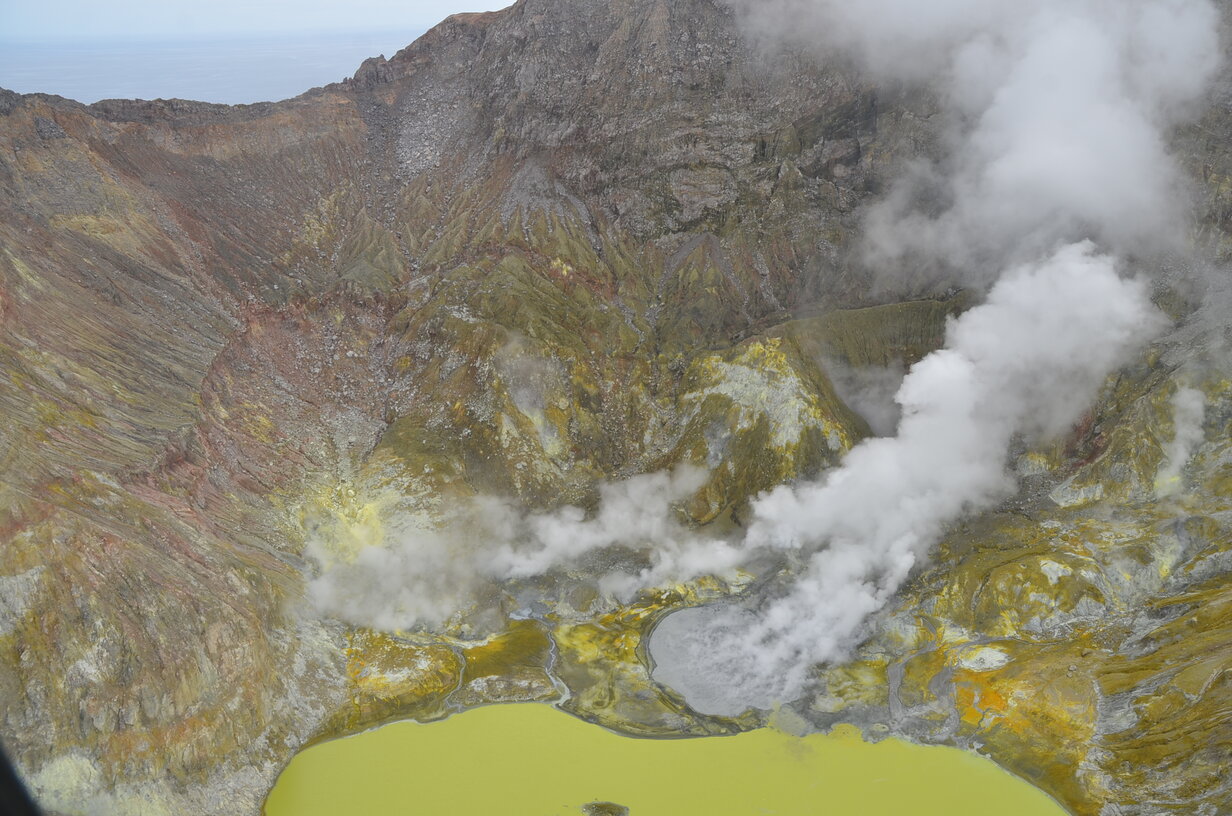
Inside the crater of White Island volcano
White Island in the Bay of Plenty ca. 50 km off the North Island's east coast is one of New Zealands most active volcanoes, well known for its spectacular crater with strong hydrothermal activity and sulphur deposits. It is part of the active Taupo volcanic zone and last erupted in 2001 (phreatic explosion).
[smaller] [larger]
Ausbrüche des White Island: 2019, 2016, 2013, 2012, 2001, 1998-2000, 1998, 1995, 1986-94, 1983-84, 1976-82, 1974, 1971, 1971, 1970, 1969, 1968-69, 1966-67, 1962, 1959, 1958, 1957, 1955, 1947, 1933, 1930, 1928, 1926, 1924, 1922, 1909, 1908 (?), 1886?,1886, 1885 (?), 1885, 1856 (?), 1836, 1826
Letzte Erdbeben in der Nähe
| Uhrzeit | Mag. / Tiefe | Entfernung / Ort | |||
| 16. Mai. 23:00 (GMT +12) | 2.5 5 km | Info | |||
| Mittwoch, 15. Mai 2024 GMT (1 Beben) | |||||
| 16. Mai. 01:47 (Auckland) | 2.4 94 km | Info | |||
| Dienstag, 14. Mai 2024 GMT (2 Beben) | |||||
| 15. Mai. 08:44 (Auckland) | 2.5 26 km | Info | |||
| 14. Mai. 19:49 (Auckland) | 2.6 110 km | Info | |||
| Montag, 13. Mai 2024 GMT (1 Beben) | |||||
| 14. Mai. 02:38 (Auckland) | 2.5 108 km | Info | |||
| Freitag, 10. Mai 2024 GMT (1 Beben) | |||||
| 11. Mai. 10:59 (Auckland) | 2.5 109 km | Info | |||
Beschreibung
Uninhabited 2 x 2.4 km White Island, one of New Zealand's most active volcanoes, is the emergent summit of a 16 x 18 km submarine volcano in the Bay of Plenty about 50 km offshore of North Island. The 321-m-high island consists of two overlapping andesitic-to-dacitic stratovolcanoes; the summit crater appears to be breached to the SE because the shoreline corresponds to the level of several notches in the SE crater wall. Volckner Rocks, four sea stacks that are remnants of a lava dome, lie 5 km NNE of White Island. Intermittent moderate phreatomagmatic and strombolian eruptions have occurred at White Island throughout the short historical period beginning in 1826, but its activity also forms a prominent part of Maori legends. Formation of many new vents during the 19th and 20th centuries has produced rapid changes in crater floor topography. Collapse of the crater wall in 1914 produced a debris avalanche that buried buildings and workers at a sulfur-mining project.(Source: GVP)
White Island Volcano Photos
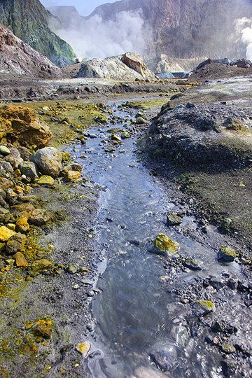
Ein kleiner Bach strömt aus dem Krater von White Island (Photo: Tom Pfeiffer)
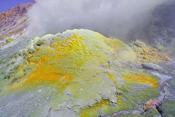
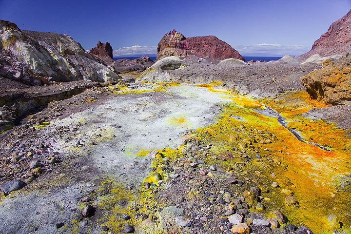
Fumarole auf White Island (Neuseeland) (Photo: Tom Pfeiffer)
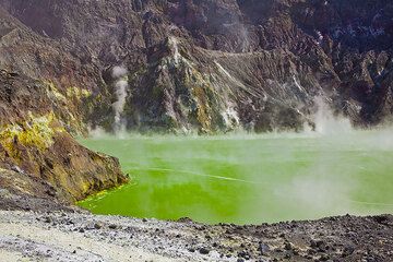
Grüner Kratersee von White Island, Neuseeland, im Jahr 2010 (Photo: Tom Pfeiffer)
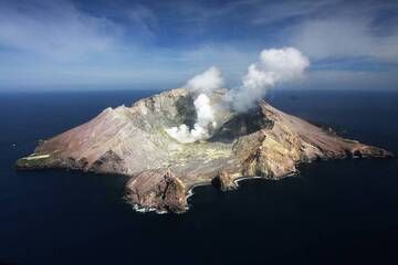
Luftaufnahme des Vulkans White Island, Neuseeland (Photo: Richard Arculus)
Ausbrüche des Vulkans White Island
2012 eruption
A new phase of activity started on 5 August 2012, following an increase in seismic activity since July. The eruption consisted in weak ash emissions from a new vent in the Crater Lake. It is the first ash emission from White Island in 12 years. ...mehr Infos
A new phase of activity started on 5 August 2012, following an increase in seismic activity since July. The eruption consisted in weak ash emissions from a new vent in the Crater Lake. It is the first ash emission from White Island in 12 years. ...mehr Infos
Latest satellite images