Machin Volcano
Updated: 16. Mai 2024 22:27 GMT -
stratovolcano 2650+ m / 8,694 ft
Kolumbien, 4.48°N / -75.39°W
Aktueller Status: unruhig (2 von 5)
Kolumbien, 4.48°N / -75.39°W
Aktueller Status: unruhig (2 von 5)
Last update: 25 Mär 2024 (elevated seismic activity)
Cerro Machín volcano is a small stratovolcano about 20 km WNW of the city of Ibagué, Colombia. Although there are no historic eruptions, Machin is considered one of the most dangerous volcanoes in Colombia, because it has produced devastating explosive eruptions in its past and will likely to continue so. Pyroclastic flow deposits have been found up to 40 km and mud flow deposits (lahars) up to 109 km distance from the volcano along the Coello and Magdalena rivers.
The last known activity took place about 800 years ago.
[smaller] [larger]
Ausbrüche des Machin: 1180 ± 150, 2100 BC ± 200, 2240 BC ± 300, 3800 BC ± 150
Letzte Erdbeben in der Nähe
| Uhrzeit | Mag. / Tiefe | Entfernung / Ort | |||
Beschreibung
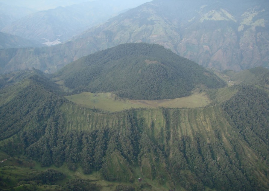
The small Machín stratovolcano forms the southern end of the Ruiz-Tolima massif. It contains a 3-km-wide caldera breached to the south. There are 3 forested dacitic lava domes inside the caldera.Machin Volcano Photos
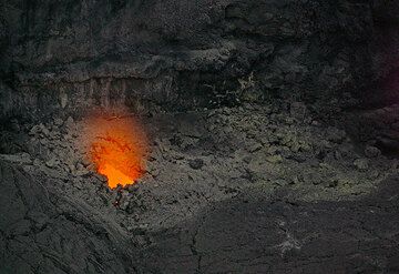
Schwacher rötlicher Schein von Magma kurz unter der Oberfläche dringt aus einem der Löcher am Boden des Einsturzkraters. Magma, das sich wenige Meter unterhalb des Bodens...
Alte Maschinen, mit denen Basalt verarbeitet wurde. Steinbruch Ettringer Ley. (Photo: Tobias Schorr)
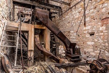
Siebmaschinen (?) und vertikaler Aufzug im unteren Mittelteil der Aufbereitungsanlage, wahrscheinlich während einer Zwischenphase des Minenbetriebs eingesetzt. (Photo: To...
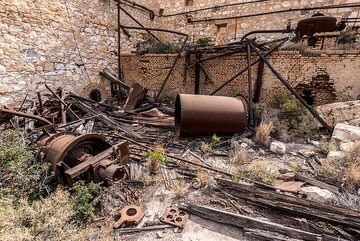
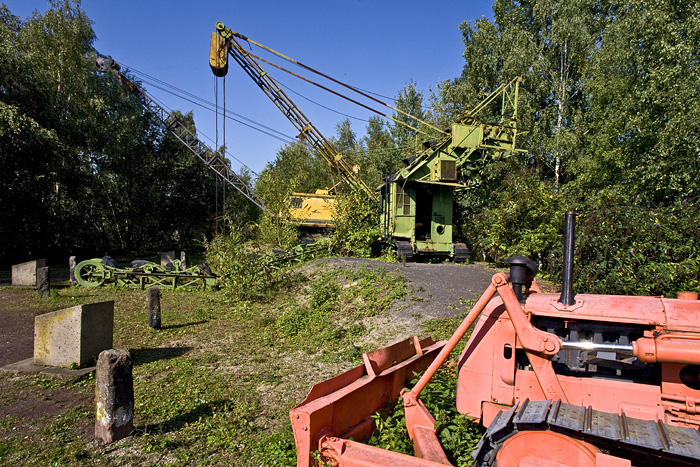
Rostende Maschinen im Hauptkesselraum. (Photo: Tom Pfeiffer)
Ausbrüche des Vulkans Machin
2011 unrest
The number of earthquakes increased at Machin volcano on 31 December 2010. Over the next 4 days, 367 volcano-tectonic earthquakes were recorded south and southwest of the main lava dome in the summit caldera.
The largest event occurred at 5:22 pm on 1 January 2011, with a magnitude 2.3 at a depth of 3.3 km. The earthquake was felt by residents in vicinity of the volcano and in the town of Cajamarca (Tolima).
(USGS / GVP weekly reports)
2008 seismic unrest
An earthquake swarm occurred at Machín volcano on 9 November 2008. The increase in earthquakes was accompanied by an increase in fumarolic activity and there was damage to some buildings (USGS / GVP weekly reports).
An earthquake swarm occurred at Machín volcano on 9 November 2008. The increase in earthquakes was accompanied by an increase in fumarolic activity and there was damage to some buildings (USGS / GVP weekly reports).
2004 seismic unrest
In April 2004, a swarm of earthquakes occurred at Machín volcano. More than 60 earthquakes occurred daily, in comparison to the normal number of 1-10 quakes. (USGS/GVP weekly updates)
In April 2004, a swarm of earthquakes occurred at Machín volcano. More than 60 earthquakes occurred daily, in comparison to the normal number of 1-10 quakes. (USGS/GVP weekly updates)
Latest satellite images